You are viewing 1 of your 1 free articles
High and dry
The Midlands includes two of the most flood-prone areas in England. Simon Brandon finds out how landlords and tenants are working to mitigate damage
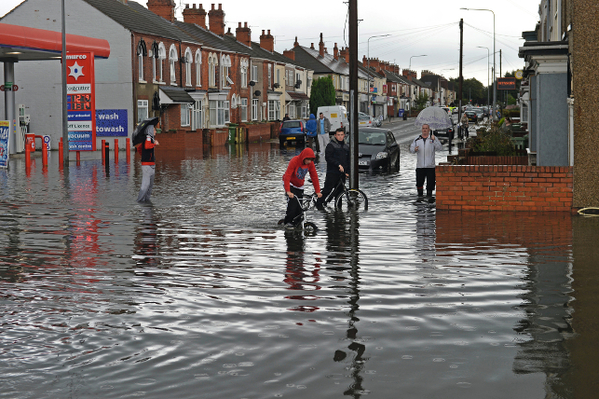
The North-East Lincoln-shire seaside town of Grimsby has flooded twice in the past 12 months. In April this year, heavy rainfall left parts of the town underwater, while in December high tides coupled with stormy weather put large areas of Grimsby on high alert.
Mark Sarjantson, 24 and currently unemployed, has lived in Grimsby his whole life. In November last year, he moved into a newly built property in the East Marsh area of the town with his partner and two children. His home is part of a development built by Longhurst Group, a landlord with 18,000 homes across the Midlands and east of England.
Mr Sarjantson believes flooding has become more of a problem in the recent past. ‘It happens more often now than it used to when I was younger,’ he says. But his new home, like the others in the development, has been built with floodwater in mind. They’re all raised up – there’s about five steps leading up [to the front door],’ he says. ‘It’s a relief to know that we’re not going to wake up and walk downstairs into a big puddle. We feel safer.’
A near neighbour, 44-year-old single mum Melanie Horridge – a 15-year resident of the town – lives in one of the new properties with her teenage son. ‘I didn’t have any problems [during the flooding],’ she says. There wasn’t even any damp.’
High and dry
Now that winter is on its way, Ms Horridge believes her home might be tested again soon. ‘We are expecting more flooding – the practice flood sirens have been going off already,’ she says. ‘Although I’m expecting the worst, I’ll be high and dry.’
High and dry is exactly right; the new homes are four feet above the terraced properties they replaced. Raising buildings like this isn’t as easy as shoving few more bricks underneath, as Tracey Pearson, project manager for Longhurst Group’s development team, explains; depending on the type of earth beneath the properties, those raised foundations can need to be strengthened.
‘Piles were driven into the ground at various points and form part of the foundation structure to support the house,’ she says. ‘The foundations wouldn’t be strong enough to hold without them.’
Serious engineering work such as this adds to the costs of development. As well as the pilings, the new homes in Grimsby required access ramps up to the raised thresholds, retaining walls and handrails, all of which accounted for around £230,000 of the development’s total £5m cost.
‘We designed in a number of measures such as building the finished floor levels of the homes 1.5 metres above ground level’
Severn Vale chief executive Tim Knight
Longhurst says it met the costs itself – there was no public funding available – and that these extras are always considered as part of the overall viability of any scheme in a flood-risk area. And that risk is evermore closely monitored now that local government planners and the Environment Agency are prioritising flood protection.
‘It’s becoming more pressing,’ says Ms Pearson. ‘It’s hard to say that [flooding] has got worse, but it has been brought to the forefront of people’s attention.’
The Midlands is a large and geographically diverse region of England, and its two areas of highest flood risk lie at opposite corners. Grimsby is situated right at the north eastern limit of the Midlands, across the Humber from Hull, while down the coast lies Boston, which was badly affected by storm surges in the flooding last December.
At the far corner of the region – almost as far as you can be from Grimsby while still being in the Midlands – are the Severn and Avon rivers, both infamously prone to flooding.
Underwater
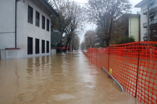
One of the enduring images of last year’s floods was the Gloucestershire town of Tewkesbury, just across the border from Worcestershire, where the two rivers converge. Photographed from the air, its shops and houses and abbey had become islands in a brown lake.
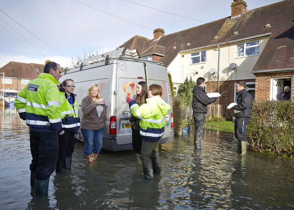
Tewkesbury is regularly inundated. In 2007, thousands of residents were forced to leave the town after the Severn burst its banks. Three local people died as a result. In 2012 and 2013, the town flooded again. But tenants living in local 3,800-home landlord Severn Vale’s 2007 Cotswold Road development in Tewkesbury were spared.
‘We had to change our plans significantly’
Stuart Turner, contract manager for Orbit Homes
‘We designed in a number of measures such as building the finished floor levels of the homes 1.5 metres above ground level,’ says Severn Vale’s chief executive Tim Knight. ‘We also built perimeter walls around the boundaries of the properties in order to provide protection. These measures have proved extremely successful [in preventing flood damage since then].’
From Tewkesbury, the Avon branches north eastwards towards Stratford-upon-Avon. Here, and in the nearby city of Coventry, 37,000-home landlord Orbit Group is proving that active flood protection begins before a brick has been laid.
Local knowledge
Orbit’s Sampson courtdevelopment in Coventry, completed in 2011, is partially built on a flood plain. The Environment Agency’s flood maps of the area located the site in flood zone 1, the lowest rating for flood risk (see box: Zonal marking), but by using close topographical checks and listening to local knowledge, Orbit realised that a large chunk of the site actually lies in flood zone 3, the highest rating for flood risk.
‘We had to change our plans significantly,’ says Stuart Turner, contract manager for Orbit Homes, Orbit Group’s development arm. ‘According to the Environment Agency’s map it looks like [zone 1] just clips the corner but in actual fact the flood levels took out about 25% of the site and made it undevelopable.’
Orbit had to reduce the number of units it planned to build, but Mr Turner says building in the flood protection measures that would have been necessary to cleave to the original plans would have been financially unsustainable.
He suggests that part of the reason Orbit decided to take a much closer look may have been a cheap and readily available flood protection measure: local knowledge.
The source of that knowledge has been ‘lost in history’, he acknowledges, and the information itself was purely anecdotal: ‘Someone will have said, “I’ve been the maintenance supervisor on this site for years and it floods all the time” – it’s not on the flood risk assessment but that anecdotal information suggests you might want to look a little closer.’
Using technology
Orbit has also been putting some slightly more modern information technology to use across the region. It was the severe flooding in 2007 that prompted this more rigorous approach, suggests Debbie Harvey, Orbit Group’s sustainability projects officer.
‘Orbit’s view previously was that flooding was caused by rivers and water sources,’ she says. ‘But [in 2007] we were hit quite badly by surface water flooding quite far away from rivers. That pushed us to look in more detail at the Environment Agency’s data and to use GIS mapping to protect us against that.’
‘We have lots of properties that we bought 30 or 40 years ago that have probably never had a flood assessment’
Debbie Harvey, sustainability projects officer at Orbit Group
GIS stands for geographical information system. It is, essentially, a method for layering maps containing different sets of data on top of one another. It has myriad uses for a housing association as large and geographically diverse as Orbit. Ms Harvey says the organisation has used it to predict which of the areas it serves are most at risk of fuel poverty. In terms of flood protection, however, it provides at-a-glance information about which properties are at risk and to what extent.
‘We have lots of properties that we bought 30 or 40 years ago that have probably never had a flood assessment,’ she says. ‘We can’t go out and do an assessment for all our properties – we have around 37,000 – so this is a way of seeing [flood risk] visually and being able to target mitigation measures at the properties that need them.’
And it enables Orbit to do that proactively rather than reactively, she adds. ‘It’s about efficiency and putting our resources in the right places.’ Orbit’s homes were unaffected by the flooding earlier this year; according to Ms Harvey, that’s evidence that she and her colleagues are on the right track.
‘That nothing got flooded in February is testament to our flood protection measures,’ she says. ‘We can’t know that 100% – but we believe it is.’
Zonal marking
The Environment Agency’s (EA’s) flood maps of England divide the country into three zones in increasing order of risk:
Zone 1 – which includes most of the country – is, according to the EA’s definition, land with a less than one in 1,000 annual probability of flooding.
Zone 2 – the medium probability area has between a one in 100 and one in 1,000 chance of flooding.
Zone 3 – has a one in 100 or greater chance of inundation in a given year.
The EA makes clear in its guidance that these flood zones do not take into account the possible impacts of climate change, and recommends local strategic flood risk assessments to assess risk to a greater degree of accuracy.
